What is the most scenic hike in Hong Kong Island?
The Peak Circle Walk, Victoria Peak Garden and High West compared against Dragon's Back, with published heights, trail timings and the Observatory data that decides which month gives you the view.
What is the most scenic hike in Hong Kong Island?
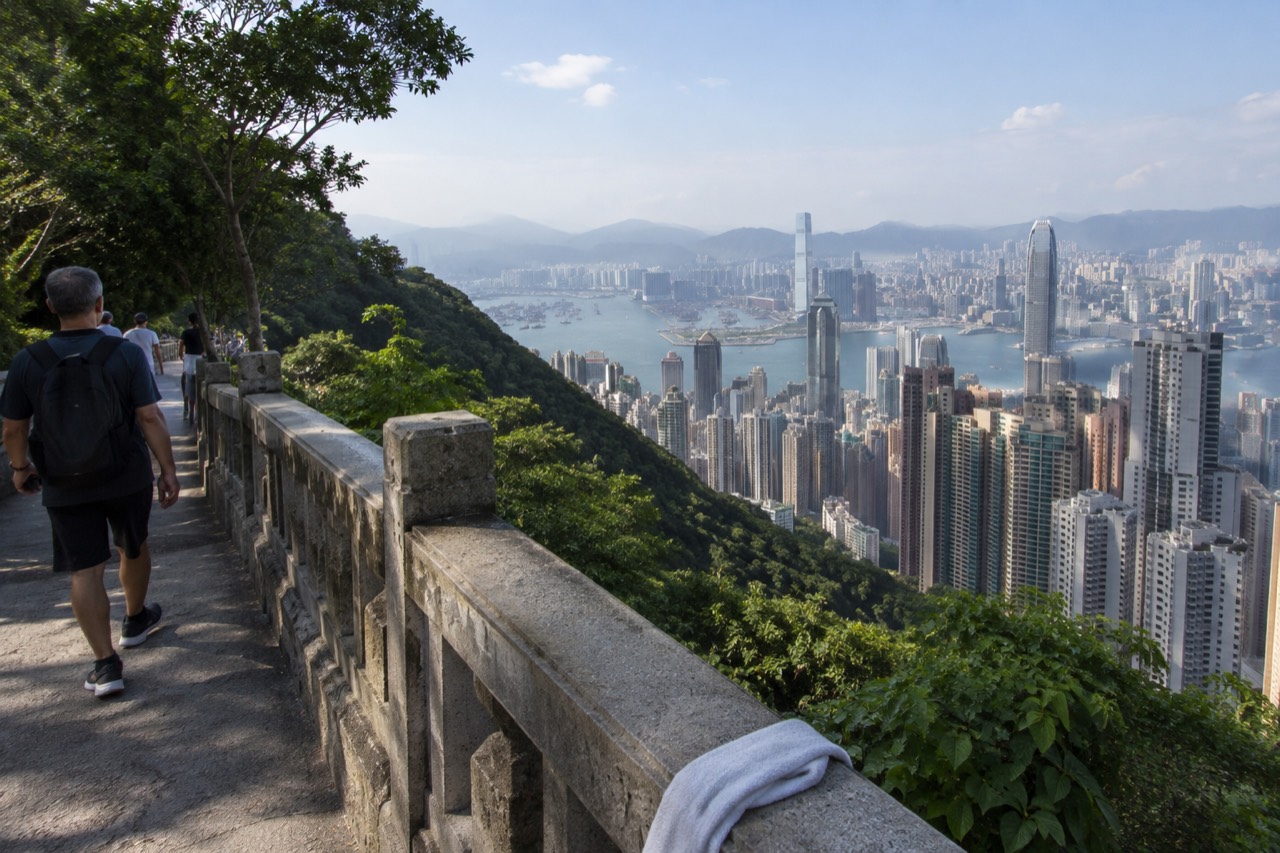
The most scenic hike on Hong Kong Island is the summit circuit around Victoria Gap: Lugard Road out, Harlech Road back, with Victoria Peak Garden at 554 metres as the high point. The Hong Kong Tourism Board grades the 3.5 km Peak Circle Walk as easy and says it "can be completed in an hour", and no other island walk puts the full harbour skyline in view for almost its entire length.
That answer will annoy the Dragon's Back loyalists, and their case is real. The ridge above Shek O is the walk that appears on international "best hike" lists, and it earns its scenery with effort: exposed ridgeline, sea on both sides, a proper climb. But the question here is scenery, not sweat. The circuit at the Peak delivers the postcard view of Victoria Harbour, the one Hong Kong is famous for, from a flat road you could walk in sandals. It is also the only major walk on the island where the view is present at the start, the middle and the end, rather than a reward at the top.
The Hong Kong Tourism Board's own Peak page lists seven stops on the circuit in order: The Peak Tram, The Peak Tower, Peak Galleria, The Peak Lookout, Peak Circle Walk, Lugard Road and Victoria Peak Garden. That is an official route, published by the tourism authority, which is more than most "best hike" articles can point to. The board also calls the Lugard Road Lookout "one of Hong Kong's best-kept secrets, offering breathtaking views without the crowds", in its own words, on its own page.
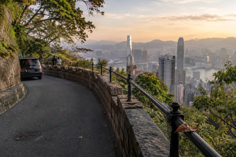
Lugard Road itself is older than almost everything it looks at. It was built between 1913 and 1914 and named for Sir Frederick Lugard, the 14th governor of Hong Kong. Early examples of the city's development still stand on it, including the white Grade II historic building at 1 Lugard Road and the Grade I historic residence at 27 Lugard Road, both listed by the tourism board on the same page as the walk itself. A hike that passes two graded historic buildings while tracing the harbour skyline is doing a lot of work per kilometre.
The circuit also connects to the wider Hong Kong Trail. The Peak operator's own published walk list runs the loop out along Lugard Road and back via Harlech Road, timed at 40 to 60 minutes: exit The Peak Tower, keep right to Lugard Road, pass the first bridge built over the city's steep hills, then turn into Harlech Road, which returns you to the start.
If you want the ride up the hill folded into the same day, the tram and deck options are worth comparing before you set off.
How the summit circuit compares with Dragon's Back
The Peak circuit wins on view density and accessibility: 3.5 km, graded easy, with the harbour skyline in sight almost throughout. Dragon's Back wins on drama and solitude, with sea views along an exposed ridge, but it offers no view of the Victoria Harbour skyline at all, because it faces the wrong way.
This is the honest trade-off, and it is worth spelling out. Dragon's Back looks south and east, over Shek O, Big Wave Bay and the open sea. It is a superb walk. But the image most people carry of "scenic Hong Kong", the one on the postcards and the tourism posters, is the north-facing wall of towers across Victoria Harbour. Only the walks around Victoria Gap give you that, and among them the Lugard and Harlech loop is the one the tourism board itself signs and grades.
There is a second, quieter argument for the summit circuit: it is a loop with exits. Lugard Road and Harlech Road are roads, with bus stops, the Peak Galleria and the tram terminus never far off the route. If the weather turns, or a companion's knees object, the walk can be abandoned without stranding anyone. A ridge walk does not offer that. The circuit is also the natural companion to the rest of a Peak day: the free rooftop deck at the Peak Galleria, which the tourism board describes plainly as "a free viewing deck", sits at the start of the route.
For a reader who wants the skyline view from the paid side as well, the Sky Terrace 428 admission alone is HK$80 at the operator's gate, and the tram-and-deck combination is HK$182 adult return. The paid deck sits at 428 metres on the roof of The Peak Tower; the free garden you can walk to is published by the operator at 554 metres. Those two numbers, printed side by side, are the whole case for walking rather than paying for height.
The Lugard Road and Harlech Road loop, turn by turn
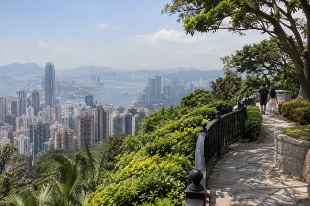
Exit The Peak Tower, keep right onto Lugard Road, follow it around the hillside past the first bridge built over the city's steep hills, then turn into Harlech Road, which returns you to the start. The operator publishes the loop at 40 to 60 minutes, and the tourism board grades the wider Peak Circle Walk as easy.
The route description comes from the Peak operator's own nature-walks page, which is rare: most hike articles invent their own turn-by-turn and get it wrong. Lugard Road runs level along the northwestern face of the hill, which is why the harbour stays in view for so much of it. The road was built a century ago as a carriage drive, and its gradient, or near absence of one, is the reason the tourism board can honestly grade the circuit easy.
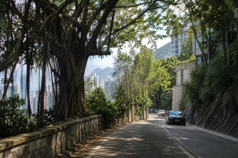
Harlech Road is the return half. It faces south, so the walk back trades the skyline for green hillsides and, in the warmer months, butterflies in the scrub. Both roads are public roads, not trails: there is no surface to worry about and no navigation required, and the two graded historic buildings on Lugard Road give the outbound leg something to look for besides the view.
The one thing no source publishes is a queue or crowd figure for any hour of any day, so timing advice has to rest on what is published. The operator's only crowd-timing sentence reads: "During public holidays or festive seasons, crowd control management will be implemented. Visitors are encouraged to purchase tickets in advance and come before 3pm during non-peak hours." That is aimed at the tram and the deck, but the same logic applies to the roads around them, which fill and empty with the same crowds.
Victoria Peak Garden: the highest ground you can stand on
Victoria Peak Garden sits at 554 metres above sea level, published by the Peak operator, which makes it the highest ground at the Peak a visitor can freely stand on, higher than the paid Sky Terrace 428 deck at 428 metres. The operator times the uphill walk along Mount Austin Road at 30 to 40 minutes.
This is the fact that reframes the whole question. The true summit of Victoria Peak, at 552 metres, is the highest point on Hong Kong Island, but it is closed to visitors and occupied by a radio installation. The garden next to it is a free public park, managed by the Leisure and Cultural Services Department, and the operator publishes it at 554 metres, roughly 1.2 km uphill from The Peak Tower along Mount Austin Road. The free park is higher than the ticketed deck. No incumbent page sets those numbers side by side.
The tourism board describes the garden as "a hidden gem above Victoria Peak, offering stunning views, charming Victorian landscaping and a serene retreat for nature lovers". The Victorian landscaping is real and attributable: the garden occupies the grounds of the old Governor's mountain lodge, and the formal flower beds and pergolas are what remain of it. A kiosk at the top sells snacks and drinks, and there is a car park, both confirmed by the tourism board and the operator, which answers the practical objection to walking away from the malls.
Mount Austin Road starts beside The Peak Tower and leads first to Mount Austin Playground, a 5 to 10 minute walk on the operator's own list, then continues uphill to the garden. There is also a dog garden in Victoria Peak Garden, opposite No. 40 Mount Austin Road, managed by the Leisure and Cultural Services Department, for anyone whose hiking companion has four legs.
| Viewpoint at the Peak | Height (metres) | Cost | What the source says |
|---|---|---|---|
| Sky Terrace 428 | 428 | HK$80 adult gate admission | Operator calls it "the highest observation deck in Hong Kong" |
| Victoria Gap, the tram terminus | 396 | Free to walk around | Tower "does not sit atop Victoria Peak but is situated in Victoria Gap" |
| Victoria Peak summit | 552 | Closed to the public | Highest point on Hong Kong Island, occupied by a radio installation |
| Victoria Peak Garden | 554 | Free public park | Operator publishes it as the highest ground visitors can reach |
| High West | 493 | Free | Tourism board calls it "one of the most famous sunset spots on The Peak" |
High West and the sunset alternative
High West, at 493 metres, is the sunset peak next to Victoria Peak, and the Hong Kong Tourism Board calls it "one of the most famous sunset spots on The Peak". It adds a fourth real height on the same hill, and a west-facing option the harbour-facing circuit does not offer.
The circuit around Victoria Gap looks north and east. High West looks west, which is where sunsets happen, and that is the entire reason it exists in the tourism board's own list of Peak places. It is the walk for a reader whose scenic moment is golden hour rather than midday skyline, and unlike the paid deck it costs nothing. The board's High West page is the source for both the height and the sunset claim, and nothing beyond that is published about the route up, so nothing beyond that belongs here.
One photography rule matters on any of these walks, and it is published rather than folklore: tripods and lighting equipment are not allowed in the Peak Tram, The Peak Tower or Sky Terrace 428, and drones are prohibited on Peak Tram and Peak Tower property without management permission. Sunset photographers planning a long exposure from the deck should know the operator's own FAQ says no to the tripod. The free roads and the garden are the places where a tripod is not barred by a published rule.
The garden and High West also share a practical weakness: no source publishes a walking time or distance from the tower to High West, and none may be invented here. What is published is the operator's timing for the garden walk, 30 to 40 minutes uphill, and the tourism board's 3.5 km circuit figure. Plan the sunset walk with those, and check the Observatory's two Victoria Peak webcams, one looking east and one looking north-northeast, which the operator itself tells visitors to consult before travelling.
Which month gives you the view
October is the clearest month on the Hong Kong Observatory's 30-year record, with 55 per cent of possible bright sunshine and 58 per cent mean cloud. March is the worst for a view, at 27 per cent sunshine and 77 per cent cloud, and its problem is fog rather than rain: 1.47 mean days with visibility under 1,000 metres.
Every figure in that answer is a Hong Kong Observatory monthly normal for 1991 to 2020, recorded at the Observatory's own station. They are Hong Kong-wide figures, not measurements taken on Victoria Peak, and saying so honestly is part of using them. But no visibility statistic specific to the Peak exists anywhere, so these normals are the best evidence any source holds, and they are a government dataset rather than a blogger's opinion.
The fog column is the one that matters, and it is the one every seasonal article ignores. February and March hold 2.57 of the year's 3.70 fog days between them, where a fog day means visibility below 1,000 metres. February looks fine on rainfall, at 38.9 mm, and rain-based advice wrongly calls it a good month. The fog count says the opposite. April still carries 0.83 fog days and 77 per cent cloud, so the spring murk has not finished when the rain starts.
| Month | Possible bright sunshine | Mean cloud | Rainfall | Mean fog days |
|---|---|---|---|---|
| January | 43% | 62% | 33.2 mm | 0.20 |
| March | 27% | 77% | 75.3 mm | 1.47 |
| June | 36% | 77% | 491.5 mm | 0 |
| October | 55% | 58% | 120.3 mm | 0 |
| November | 52% | 58% | 39.3 mm | 0 |
| December | 48% | 57% | 28.8 mm | 0.03 |
The autumn run is the answer the numbers give. November is nearly as clear as October and nearly dry, at 39.3 mm of rain. December has the lowest mean cloud of the whole year at 57 per cent and the lowest rainfall at 28.8 mm, which contradicts the assumption that winter is a poor time to go up. The trade-off flips in May, when fog all but vanishes but rain takes over, 290.6 mm across 15.37 wet days. June is the wettest month at 491.5 mm over 19.33 wet days.
There is one closure rule that turns weather into a plan: when a tropical cyclone warning signal no. 8 or above, or a special inclement weather warning, is hoisted, the Peak Tram and Sky Terrace 428 close. The Observatory's normals even put a number on the risk by month, 0.80 signal-8 days in August and 0.67 in September, against nil from November through April. The roads up the hill stay open to buses when the tram shuts, which is when the published alternatives matter: Citybus route 15 at HK$13.00, route X15 at HK$16.80 and green minibus route 1 at HK$11.80, all full adult fares.
Getting to the trailhead without hiking up from Central
The cheapest published way to the trailhead is green minibus route 1 at HK$11.80 from the Hong Kong Station transport interchange, with Citybus route 15 at HK$13.00 from the Central Ferry Piers as the alternative. The Peak Tram's adult single gate fare is HK$82, and the tram is a ride, not a hike.
Readers who want the scenic hike without the scenic commute have a real choice, and the fares are published in the Transport Department's open data. The minibus is the cheapest of any way up the hill, and its Central end is the Hong Kong Station Public Transport Interchange, so anyone arriving on the Airport Express or the Tung Chung line can reach it without going to Central station at all. The buses start among the Central Ferry Piers, the same complex as the Star Ferry, which makes them the natural second leg for a reader coming from Kowloon.
The tram is the third option and the most expensive, and it is worth being precise about what it is: a double reversible funicular on 1,278 metres of track, climbing from the Central Terminus at 33 metres above sea level to the Peak Terminus at 396, in a journey the operator times at approximately 6 minutes. It is not the flat double-decker "ding ding" tram on Hong Kong Island, which never goes up the hill. Since the August 2022 rebuild it carries 210 passengers, 167 seated and 43 standing, in Swiss-built cars painted a colour the operator calls Peak Tram Green.
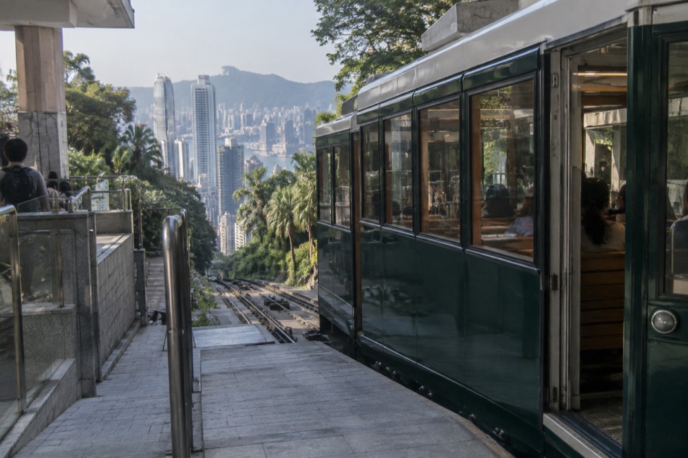
A ticket bought in advance is a standard ticket, not a queue-priority product. The operator states plainly that its timed tickets "do not provide priority boarding" and that queueing time depends on visitor numbers on the day; buying ahead removes the ticket-counter line, not the boarding line. The hours are worth checking too, because the tram runs from 7:30 am while Sky Terrace 428 does not open until 8:30 am, so an early combo ticket cannot be used in full on arrival. The full hours and fare detail, including the one-way trap in the headline price, are covered in the site's guide to Peak Tram hours and fares.
For the hike-first plan, though, the arithmetic favours the bus. A reader who rides up on minibus route 1, walks the circuit, climbs to the garden and comes down on the Pok Fu Lam walk, which the operator times at 35 to 45 minutes down to Pok Fu Lam Road past the reservoir, has spent HK$11.80 on transport and nothing on admission, and has stood on the highest public ground on the island. That is a defensible claim to the most scenic hiking day Hong Kong Island offers, and it is built entirely from published figures.
The one thing to keep straight is what the summit actually is. Victoria Peak, at 552 metres, is the highest point on Hong Kong Island, but it is not the highest peak in Hong Kong: the tourism board gives that to Tai Mo Shan. The tram does not take you to the summit either; it stops in Victoria Gap at 396 metres, and the operator says so itself. The scenic hike is the thing that closes the gap between the terminus and the view, and this site, Victoria Peak Hong Kong, exists to document exactly that. For more on the free high ground, see the guide to Victoria Peak Garden and the summit, and for the ridge alternative, the walk down from the top is covered in walking down from the Peak.
If the plan is tram up, hike the circuit, bus down, the ticket options below cover the ride.
Common questions about the most scenic hike on Hong Kong Island
What is the most scenic hike in Hong Kong Island?
The summit circuit around Victoria Gap: Lugard Road out, Harlech Road back, with Victoria Peak Garden at 554 metres as the high point. The Hong Kong Tourism Board grades the 3.5 km Peak Circle Walk as easy and says it "can be completed in an hour", and the harbour skyline stays in view for almost the whole route.
Is the Peak Circle Walk difficult?
No. The Hong Kong Tourism Board grades it easy, in its own words, and it follows flat public roads rather than trails. The operator times the Lugard and Harlech loop at 40 to 60 minutes, and the optional uphill extension to Victoria Peak Garden at 30 to 40 minutes.
Is Victoria Peak the highest point in Hong Kong?
It is the highest point on Hong Kong Island, at 552 metres, but not the highest in Hong Kong. The tourism board gives that title to Tai Mo Shan. The Victoria Peak summit itself is closed to the public and occupied by a radio installation; the highest ground visitors can reach is Victoria Peak Garden, published by the operator at 554 metres.
Do you have to pay to see the view from the Peak?
No. The Peak Galleria rooftop is a free viewing deck in the tourism board's own words, and Lugard Road, Harlech Road and Victoria Peak Garden are free public spaces. The paid option, Sky Terrace 428 at HK$80 adult gate admission, buys the 428-metre roof of The Peak Tower.
When is the best month for a clear view from the hike?
October, on the Hong Kong Observatory's 1991 to 2020 normals: 55 per cent of possible bright sunshine and 58 per cent mean cloud. November and December are close behind, with December the least cloudy month of the year at 57 per cent. March is the worst, at 27 per cent sunshine and 1.47 mean fog days.
Can you hike down from the Peak instead of taking transport?
Yes. The operator's published walk list includes the Pok Fu Lam Country Park route, 35 to 45 minutes down past the Peak Lookout and the reservoir to Pok Fu Lam Road. Old Peak Road also runs between the top of the hill and Mid-Levels, though no official page for it is held beyond its existence.
If the day ends with a ride back down instead of a walk, these are the ticket options worth comparing.