What can I do walking down from Victoria Peak?
The descent from the Peak is a plan of its own: the Pok Fu Lam walk down, Old Peak Road, the bus and minibus fares, and where each route pops out.
What can I do walking down from Victoria Peak?
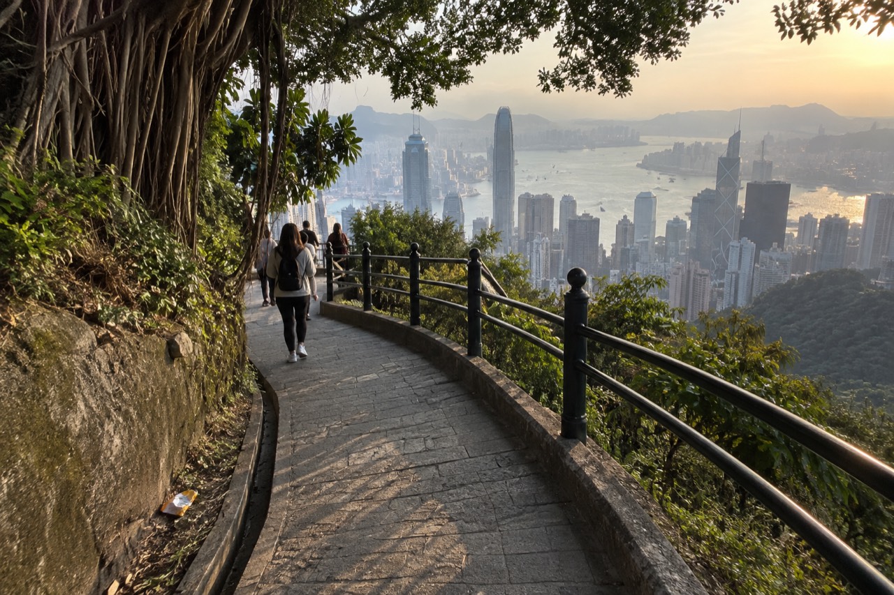
You have three real walking options down: the Pok Fu Lam Country Park route, which the Peak operator times at 35 to 45 minutes and which ends at Pok Fu Lam Road; Old Peak Road, which runs between the top of the hill and Mid-Levels; and the Peak Circle Walk's connecting roads, which the tourism board grades as easy and measures at 3.5 km. Each pops out somewhere different, and each changes what your return leg costs.
The way down is not just the way up in reverse. Going up, the question is the tram or a bus. Coming down, the walking routes become genuinely attractive: the grade works in your favour, the views open toward the harbour instead of away from it, and two of the three routes end somewhere a bus, minibus or MTR connection is waiting.
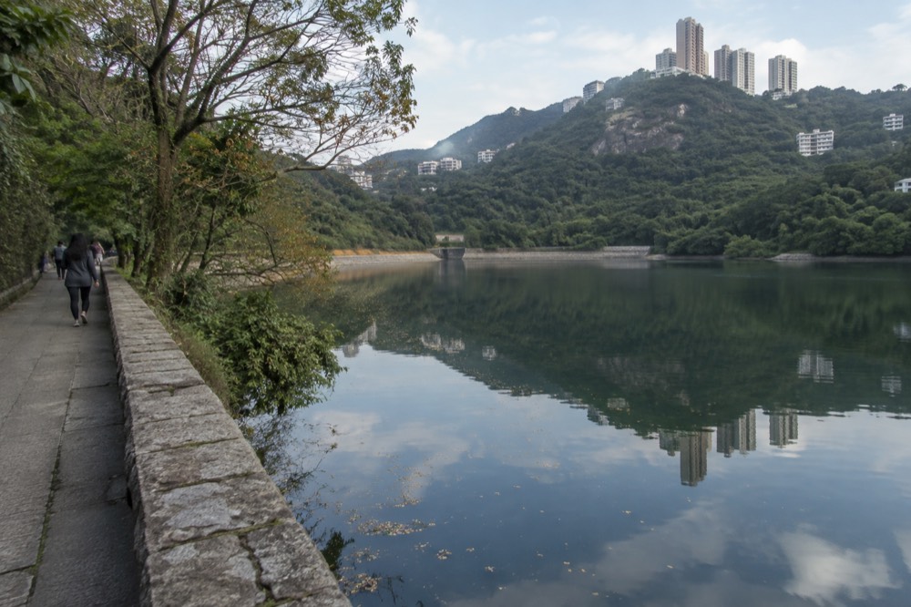
The honest starting point is that only one of the walking descents carries a published timing. The Peak operator's own walk list gives the Pok Fu Lam Country Park route at 35 to 45 minutes, heading south past the Peak Lookout Restaurant, down to the Hong Kong Trail sign, past Pok Fu Lam Reservoir and out at Pok Fu Lam Road. That is a primary source, published by the operator, and it is the only descent with a number attached.
Old Peak Road is different. It exists, it runs between the top of the hill and Mid-Levels, and beyond that our sources say nothing. No official page for it is held, so no duration, gradient or surface description may honestly be written. Plenty of forum posts offer impressions; none of them is a source, and a visitor's "20 minutes downhill" is one person's legs, not a published figure.
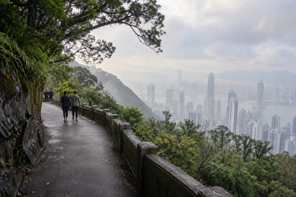
The Peak Circle Walk itself is a loop rather than a descent, but its roads matter here. The Hong Kong Tourism Board grades the whole 3.5 km circuit as easy and states it "can be completed in an hour", and its seven official stops run from the tram, through the Peak Tower and the Peak Galleria, out along Lugard Road and back via Victoria Peak Garden. Sections of it are how you reach the start of the walking-down routes.
If the plan is tram up and legs down, the ticket arithmetic is worth a look before you commit. A one-way adult tram ride is HK$82 at the operator's gate, against HK$116 for the return, so walking one direction saves the difference and, on the Pok Fu Lam route, drops you on a road with its own connections. The tram's own numbers are worth knowing too: the line climbs from the Central Terminus at 33 metres above sea level to the Peak Terminus at 396 metres on 1,278 metres of track, and the ride takes approximately 6 minutes one way.
Which routes down from the Peak are worth walking?
The Pok Fu Lam Country Park walk is the route with a published time and a reservoir on the way down; Old Peak Road is the direct line to Mid-Levels with no published details; and the Lugard and Harlech Road loop, timed at 40 to 60 minutes by the operator, is a circuit of the top rather than a descent. Choosing between them is really choosing where you want to pop out.
Start with the Pok Fu Lam route, because it is the best documented. The operator's turn-by-turn description sends you south past the Peak Lookout Restaurant, down to the Hong Kong Trail sign, past Pok Fu Lam Reservoir and on to Pok Fu Lam Road. The timing, 35 to 45 minutes, is the operator's own. What makes it the strongest walking-down answer is that it is also the walk-down route the operator frames as removing the need for a return tram fare: you end at a road, not back at the top.
Old Peak Road is the second option, and the honest description is short. It runs between the top of the hill and Mid-Levels. That is what the map records held for this site establish, and it is all they establish. Mid-Levels puts you above Central with escalator links and plenty of buses below, which is why people walk it, but nothing about its length or condition is published in any source we hold, so nothing more can be said.
The third walking option is not a descent at all but belongs in the plan. The operator's own route for the Hong Kong Trail loop runs out along Lugard Road and back by Harlech Road: exit The Peak Tower, keep right to Lugard Road, pass the first bridge built over the city's steep hills, then turn into Harlech Road, which returns you to the start. The operator times it at 40 to 60 minutes. Lugard Road itself was built between 1913 and 1914 and is named for Sir Frederick Lugard, the 14th governor of Hong Kong, and the tourism board calls it "a great spot to enjoy sunset and night views of Victoria Harbour".
| Route | What it is | Published timing | Where you end up |
|---|---|---|---|
| Pok Fu Lam Country Park walk | Descent past the Peak Lookout and Pok Fu Lam Reservoir | 35 to 45 minutes, per the Peak operator | Pok Fu Lam Road |
| Old Peak Road | Road between the top of the hill and Mid-Levels | None published | Mid-Levels, above Central |
| Lugard and Harlech Road loop | Circuit of the top along the Hong Kong Trail | 40 to 60 minutes, per the Peak operator | Back at The Peak Tower |
| Peak Circle Walk | Full official loop of the Peak | 3.5 km, "can be completed in an hour", per the tourism board | Back at the start |
A word on what the loop routes give you that the paid deck does not. Lugard Road carries two graded historic buildings, the white Grade II building at 1 Lugard Road and the Grade I residence at 27 Lugard Road, and the tourism board describes the signed Lugard Road Lookout as "one of Hong Kong's best-kept secrets, offering breathtaking views without the crowds". The free viewing deck at the Peak Galleria is the other free answer at the top, covered in detail on our Peak Galleria free deck guide, and it costs nothing to compare before you spend anything.
How long does walking down from the Peak really take?
The one descent with a published time is the Pok Fu Lam route, at 35 to 45 minutes from the Peak operator's own walk list. The other published figures at the top are loops or climbs, not descents: the Lugard and Harlech circuit at 40 to 60 minutes, the Peak Circle Walk at 3.5 km completable in an hour, and Victoria Peak Garden at 30 to 40 minutes uphill. Nothing else carries a number.
The scarcity of published timings is itself the information. Travel blogs routinely print confident durations for Old Peak Road and for the walk from the top down to Central, and none of those numbers traces to a source. The Peak operator publishes a walk list with timings for its routes, the tourism board publishes one distance and one duration for the Peak Circle Walk, and between those two documents the honest record ends.
Two practical notes sit alongside those numbers. First, the operator's timings are its own, for its listed routes, and they are not adjusted for fitness, luggage or photography stops. Second, the descent direction changes the risk profile: the Pok Fu Lam route passes a reservoir and country park terrain, and the tourism board's "easy" grade applies to the Peak Circle Walk specifically, not to every road on the hill. Claiming a difficulty grade for Old Peak Road or the Pok Fu Lam path would be invention.
Weather belongs in the timing question too, because a walk down in Hong Kong's wettest month is a different plan from one in its clearest. The Hong Kong Observatory's 1991 to 2020 normals, which are Hong Kong-wide figures rather than measurements taken on the Peak, put June as the wettest month of the year at 491.5 mm of rain across 19.33 wet days, while October is the clearest at 55 per cent of possible bright sunshine and 120.3 mm of rain. February and March carry the fog risk, with 1.10 and 1.47 mean days of visibility under 1,000 metres respectively. If the descent is a centrepiece of the day rather than a shortcut, the monthly numbers argue for the autumn window.
What is Old Peak Road actually like?
Old Peak Road runs between the top of the hill and Mid-Levels, and that verified fact is where the honest description ends. No official source held for this site publishes its length, its gradient, its surface or a walking time, so any confident account of it elsewhere is filling a gap with a guess. What can be said is where it lands you: Mid-Levels, above Central, with the rest of the city's transport below.
The gap matters because Old Peak Road is the descent most often recommended and least often documented. It appears in forum threads and listicles with durations attached, and those durations never trace anywhere. The record held here, resolved through public map data, establishes the road exists and where it runs, and stops there.
What a walker can lean on instead is geography. Mid-Levels sits above Central, and the roads below it connect into the same network that serves the tram's lower terminus at 33 Garden Road. The published walking directions to that terminus, from the booking listing's own text, start from Central MTR Exit J2, through Chater Garden, across Queen's Road Central and up Garden Road, with the Bank of China Tower and Citibank Plaza on the left and St John's Cathedral on the right. That text states no distance and no duration, and none may be added, but it does confirm the lie of the land between Mid-Levels and the bottom of the hill.
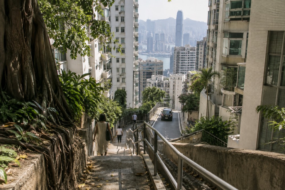
The other thing worth saying about Old Peak Road is what it is not. It is not part of the Peak Circle Walk, it is not on the operator's published walk list, and it carries none of the historic-building detail that Lugard Road does. If a walker wants a documented route with a published time, the operator's list is the place to look; if they want the direct line to Mid-Levels, the road exists and the rest is their own assessment on the day.
Can you walk down to Pok Fu Lam instead of Central?
Yes, and it is the best-documented descent of the lot. The Peak operator's walk list sends you south past the Peak Lookout Restaurant, down to the Hong Kong Trail sign, past Pok Fu Lam Reservoir and out at Pok Fu Lam Road, and times it at 35 to 45 minutes. It is also the route that removes the need for a return tram fare, because you finish downhill, not back at the top.
The Pok Fu Lam route earns its place in the plan for three reasons. It is published, turn by turn, by the operator that runs the top. It has a timing attached, 35 to 45 minutes, from the same list. And it ends at a road rather than at a tourist terminus, which means the return leg is ordinary Hong Kong transport rather than a queue for a ride.
What the route gives you on the way down is country park rather than city. The operator's description passes the Peak Lookout Restaurant first, then the Hong Kong Trail sign, then Pok Fu Lam Reservoir, before reaching Pok Fu Lam Road. The reservoir section is the scenic heart of it. The trade-off is that Pok Fu Lam Road is on the south and west side of the island, so the finish is not Central; the walker is committing to a different part of the city than the one the tram started from.
For anyone pairing this descent with a tram ride up, the fare structure rewards the plan. The operator's published gate fares put an adult single tram ride at HK$82 against HK$116 for a return, and the Special Combo, tram plus one Sky Terrace 428 admission, at HK$146 single against HK$182 return. Walking one direction saves the difference and, more usefully, saves the descent being a repeat of the ascent. The booking listing for the tram, rated 4.6 across 41,347 reviews, sells one-way and round-trip options separately, so the single-up plan is a normal purchase rather than a workaround.
What should you know before walking down?
Three published facts shape the walk: there is no luggage storage at the Peak Tram stations or in The Peak Tower, tripods and lighting equipment are banned on the tram, in the tower and on Sky Terrace 428, and when a tropical cyclone warning signal no. 8 or above is hoisted the tram and the deck both close. Beyond those, the rules are ordinary hillside common sense.
The luggage point decides the day for a specific and common visitor, the one routing the Peak between a hotel checkout and a flight. There is no luggage storage at the Peak Tram stations or in The Peak Tower, the operator states plainly, so a descent on foot with a suitcase is a different proposition from a descent with a daypack. Anyone in that position should plan the Peak as a stop on the way to somewhere luggage can go, not as a stop in the middle of a hauling day.
The photography rule catches people the other way. Tripods and lighting equipment are not allowed in the Peak Tram, The Peak Tower or Sky Terrace 428, and drones are prohibited on the operator's property without management permission. A walker carrying a tripod down from the top will have carried it up the tram first, where it was not allowed. Handheld is the rule on the operator's property; the free roads outside it are not covered by that policy in any source held.
Weather and closure rules are the third leg. The evergreen rule, published in the operator's FAQ, is that when a tropical cyclone warning signal no. 8 or above, or a special inclement weather warning, is hoisted, the Peak Tram and Sky Terrace 428 close. On a signal-8 day the roads are how people get up and down, and a walker already at the top when a signal rises should be thinking about buses, not paths. The operator itself recommends checking the Hong Kong Observatory's two Victoria Peak webcams before travelling, one looking east and one looking north-northeast, which is a live visibility check no seasonal advice can replace.
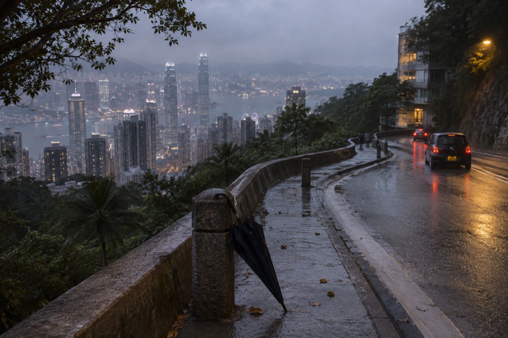
Timing at the top has one more trap worth knowing before a walk-down plan is locked in. The Peak Tram runs from 7:30 am to 11 pm, The Peak Tower is open 7 am to 11 pm, but Sky Terrace 428 opens only at 8:30 am and closes at 10 pm, every day including public holidays. A walker who rides up on the first tram of the day arrives an hour before the deck opens, and one who lingers for the night view past 10 pm finds the deck shut while the tower is not. The only published crowd guidance anywhere is the operator's own: visitors are "encouraged to purchase tickets in advance and come before 3pm during non-peak hours".
Should you take the tram up and walk down?
For most visitors, yes: the tram up and the Pok Fu Lam walk down is the strongest combination, because the ascent gets the ride and the 396-metre terminus, the descent is the operator's own documented route at 35 to 45 minutes, and the single fare at HK$82 beats the return at HK$116. The reverse, walking up and tramming down, suits a different reader, the one who wants the ride as the reward.
The case for tram-up-first is mostly about energy and partly about the fare ladder. The tram's climb, from 33 metres above sea level to 396, on a gradient that runs from 4 degrees to 25.7 degrees at its steepest below May Road, is a 6-minute ride; doing it on foot first and riding down afterwards means the legs pay before the view does. The fare ladder agrees: HK$82 adult single against HK$116 return, and for the deck-included versions, HK$146 single against HK$182 return. One direction on foot keeps the cheaper line.
The reverse plan has its own logic. Walking up from Central, which our walking up from Central guide covers in full, puts the tram ride at the end of the day as the seated reward, and the return leg is where tired legs are gladdest to pay. The tram's 210-passenger sixth-generation cars, 167 seated and 43 standing, rebuilt in August 2022, make that a more comfortable bet than the pre-2022 system ever was, and step-free access was part of the same rebuild.
One caution belongs to both plans. This is a standard ticket, not a fast-track product: buying ahead puts you in the "Pre-purchased Ticket Holder" queue, which removes the ticket-buying line, not the boarding line, and the operator states its timed tickets "do not provide priority boarding" and that queueing time depends on the number of visitors on the day. No queue duration may honestly be stated for any hour or season, because no source publishes one. The genuine priority product is a different, dearer option, the Ruby Special, published at HK$342 adult.
The descent, in the end, is the part of the Peak day that most itineraries treat as an afterthought and that rewards the opposite treatment. The operator's own walk list gives the Pok Fu Lam route a time, a turn-by-turn line and a finish point on a road with transport below it. The tourism board's own words grade the loop above it as easy. Between those two official documents, a walker can plan the way down as carefully as the way up, which is the whole point of a site like Victoria Peak Hong Kong: the ride is six minutes, and the hill is the better half of the day.
For the walker who only wants the one-way leg and nothing else, the plain single tram option is the leanest purchase on the roster: HK$82 at the gate for a one-way adult ride, tram only, no deck admission, which pairs exactly with a Pok Fu Lam descent. It is the version to pick when the plan is ride up, walk down, and never double back.
That combination, one-way ride up and legs down, is also the cheapest honest way to structure the day without giving up the ride itself. The deck, the loop and the garden above can all be added or skipped on their own terms, and the three options below cover the main ways visitors buy them.
Common questions about walking down from Victoria Peak
What can I do walking down from Victoria Peak?
You can walk the Pok Fu Lam Country Park route, published by the Peak operator at 35 to 45 minutes and ending at Pok Fu Lam Road; take Old Peak Road, which runs between the top of the hill and Mid-Levels with no published timing; or finish the Peak Circle Walk loop, 3.5 km and graded easy by the tourism board, before descending by bus, minibus or tram.
How long does it take to walk down from the Peak?
The only published descent time is the Pok Fu Lam route, 35 to 45 minutes from the operator's own walk list. No source publishes a time for Old Peak Road or for any walking route down to Central, so any figure you read for those is a guess rather than a fact.
Can you walk down from the Peak to Central?
Old Peak Road runs between the top of the hill and Mid-Levels, which sits above Central, so a walk down toward Central is possible in stages. No official source held here publishes a distance or a time for that route, and none may be invented.
Is it cheaper to walk down instead of taking the tram back?
Yes, by the fare difference. The operator's published gate fares put an adult single tram ride at HK$82 against HK$116 for a return, so tram up and walk down keeps the cheaper fare and skips the ride down. The Pok Fu Lam route even finishes at a road with its own transport connections.
Is the walk down from the Peak difficult?
The tourism board grades the Peak Circle Walk as easy, and that is the only difficulty grade published for any route here. No grade exists for Old Peak Road or the Pok Fu Lam descent, and the operator's timings for its routes do not come with a difficulty rating.
Does the Peak Tram close in bad weather?
Yes. When a tropical cyclone warning signal no. 8 or above, or a special inclement weather warning, is hoisted, the Peak Tram and Sky Terrace 428 close, per the operator's FAQ. On those days the road services, bus 15 at HK$13.00, X15 at HK$16.80 and green minibus 1 at HK$11.80, are the way up and down.