The Victoria Peak View: What You Are Actually Looking At
The panorama from the Peak is one of the most photographed city views on earth, but almost nobody can name what they are looking at. This guide reads it left to right, tower by tower, and separates the heights you can pay for from the ones you cannot.
Short answer
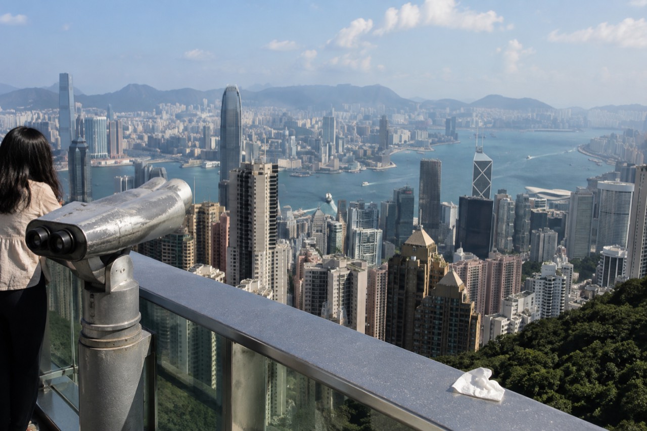
From the Peak you look across Victoria Harbour at Kowloon, back down at the Hong Kong Island skyline, and out to Lantau and the outlying islands. The free rooftop deck at the Peak Galleria and Lugard Road both give the panorama; Sky Terrace 428 adds height at 428 metres on the Peak Tower roof, from HK$80 for admission alone.
The view from the Peak is the reason the Peak exists as an attraction. The tram, the tower, the tickets and the queues are all scaffolding around one thing: a hillside 396 metres above the city, looking down at a harbour and a skyline that changes character with every hour of daylight. Yet most visitors come down unable to name a single building they saw, because almost every guide describes the view as an experience rather than as a place with geography.
This page does the opposite. It reads the panorama left to right, names the towers and the islands, explains the four different heights people confuse at the top, and tells you honestly which parts of the view cost money and which are free. The free parts are real, and the Hong Kong Tourism Board recommends them in its own words, which is why Victoria Peak Hong Kong as a site can afford to be straight with you about the paid deck.
What can you actually see from the top of the Peak?
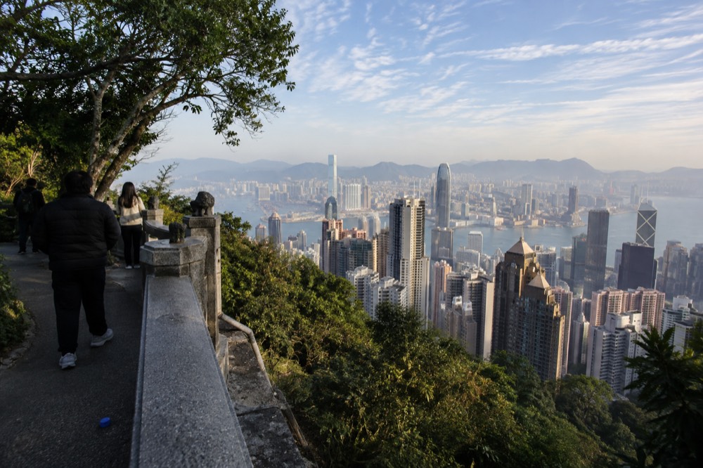
From the viewing points at the top you can see, in one sweep: the Hong Kong Island skyline below you, Victoria Harbour and the Star Ferry crossings, the Kowloon peninsula directly opposite, the New Territories hills behind it, and, on a clear day, Lantau and the outlying islands to the west and south. The summit of Victoria Peak itself is closed to the public, so every view you get is from the Gap and the roads around it.
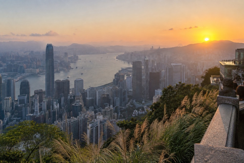
The first thing to understand is that the postcard view, the one with the skyscrapers stacked below you, faces north and east. You are standing on the side of a hill looking down at the northern shore of Hong Kong Island, with the harbour between you and Kowloon. Turn around and the view changes completely: the southern side looks out over Aberdeen, the South China Sea and green hills, and it is much quieter.
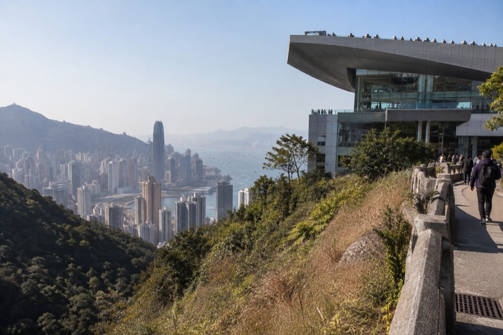
The second thing is that the tram does not take you to the top of the mountain. The operator states plainly that The Peak Tower "does not sit atop Victoria Peak but is situated in Victoria Gap, a dip along the line of the hills at an elevation of 396 metres". Everything people photograph from the top is photographed from that dip and from the roads around it, not from the summit.
The third thing is that the view is free at several points, a fact the tourism board states on its own pages when it calls the Lugard Road Lookout "one of Hong Kong's best-kept secrets, offering breathtaking views without the crowds". The paid deck sells height and a 360-degree platform, not access to the panorama itself. The rest of this guide works through what you are looking at, then through where to stand to look at it.
Four heights, one hill: which viewpoint is which?
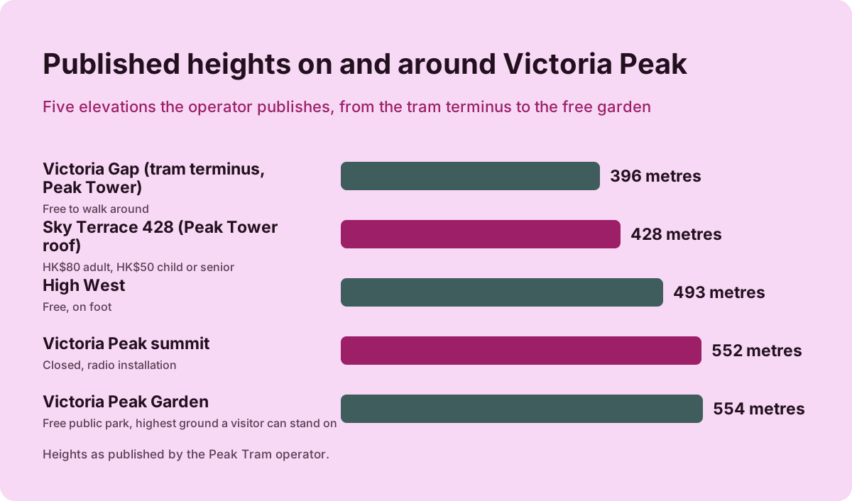
The hill has four published heights and people constantly mix them up: Victoria Gap at 396 metres is where the tram stops and the tower stands; the Sky Terrace 428 roof is at 428 metres; the true summit of Victoria Peak is 552 metres and closed to the public; and Victoria Peak Garden, a free public park, is at 554 metres, the highest ground a visitor can stand on. High West, the sunset peak next door, is 493 metres.
The operator publishes all of these numbers, and the strange one is the pair at the end. The free park is published higher than the paid deck, 554 metres against 428, and no incumbent page puts those two numbers side by side. Do not try to reconcile the 552 of the summit with the 554 of the garden: the operator publishes both, each for its own subject.
| Place | Height | Can you go? | Cost |
|---|---|---|---|
| Victoria Gap (tram terminus, Peak Tower) | 396 m | Yes, the tram stops here | Free to walk around |
| Sky Terrace 428 (Peak Tower roof) | 428 m | Yes, with admission | HK$80 adult, HK$50 child or senior |
| Victoria Peak summit | 552 m | No, closed, radio installation | Not open to the public |
| Victoria Peak Garden | 554 m | Yes, free public park | Free |
| High West | 493 m | Yes, on foot | Free |
The summit itself is occupied by a radio installation and is not a place you can visit, which is worth knowing because a surprising amount of online copy implies otherwise. The highest ground the public can freely reach is the garden uphill along Mount Austin Road, which the operator's own walk list gives as a 30 to 40 minute uphill walk from the tower, roughly 1.2 km along the road.
Choosing between these heights is really choosing a format. The deck is a purpose-built platform with a 360-degree circuit; the garden is a landscaped park with Victorian planting and a kiosk; Lugard Road is a flat road loop with the harbour constantly in view. If you want to read the skyline rather than just stand above it, the free options do the job, and the Lugard Road loop and Victoria Peak Garden each have their own guides on this site.
Reading the skyline left to right
Facing the harbour from east to west, the Hong Kong Island skyline below you runs from the old Victoria Barracks and Admiralty in the east, through Central with the Bank of China Tower and the IFC towers, past the Mid-Levels you climbed through, and on to Sheung Wan and Western District in the west. The two towers most visitors can pick out are the IFC Two tower in Central and the Bank of China Tower with its triangular prisms.
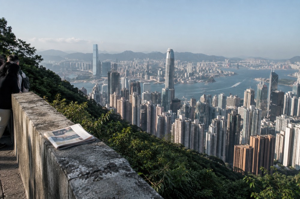
Start at the eastern end. The green space closest to the water on that side is the former Victoria Barracks ground, now parkland, and behind it the towers of Admiralty march eastward toward Wan Chai. Moving west, the skyline thickens as you reach Central, the financial district, where the two towers that anchor any photo stand out. The listing's own walking directions to the tram terminus name the Bank of China Tower as a landmark on Garden Road, which tells you how close it is to where you started: you rode up past it.
Below you, between the towers and the water, sit the Star Ferry piers, the outlying islands ferries and the reclaimed land that keeps pushing the shoreline north. The reclamation is visible from the top as a series of straight edges, because natural coastlines do not run in straight lines. Every flat kilometre of the northern shore between Central and Wan Chai is land that used to be harbour.
| Skyline landmark, east to west | Where it sits | What to look for |
|---|---|---|
| Admiralty and Wan Chai towers | Eastern end of the skyline | The dense band running east from the parkland |
| Bank of China Tower | Central | Sharp triangular prisms, close to Garden Road |
| IFC towers | Central, by the ferry piers | The tall paired towers at the water's edge |
| Mid-Levels residential towers | On the slope below you | The wall of apartment blocks you climbed past |
| Sheung Wan and Western | Western end | Lower, older blocks thinning toward the hills |
The Mid-Levels wall deserves its own look. Those are the residential towers on the slope directly below the Peak, and the tram line runs between them, which is why the ride feels like it is threading through people's living rooms. From the top you can trace Garden Road, the road you would walk down, and Old Peak Road, the older walking route that runs between the top of the hill and Mid-Levels. The walking down from the top route puts that whole slope under your feet.
Kowloon across the water
Directly opposite, across Victoria Harbour, the Kowloon peninsula runs from the old Kai Tak runway in the east, through Tsim Sha Tsui with its clock tower and museum frontage, to the West Kowloon cultural district in the west. Behind it the Kowloon hills, including Lion Rock, rise up, and on clear days you can see the New Territories beyond. The green dot of Stonecutters Island and the container port sit at the western end.
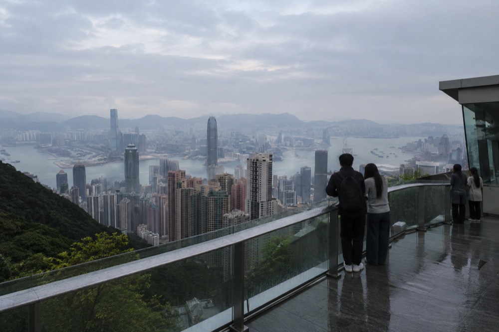
Kowloon is the half of the view people under-prepare for. The peninsula is lower and less dramatic than the island skyline, but it carries the landmarks that date the photograph. The Tsim Sha Tsui clock tower at the tip is the single most identifiable structure on that shore, and the avenue of towers behind it faces you across the narrowest part of the harbour. At night the whole frontage lights up, and the Symphony of Lights show plays across this stretch of water, which is why the Peak after dark has its own guide.
The harbour itself is the working part of the view. Ferries cross it constantly, and the Star Ferry route between Central and Tsim Sha Tsui is visible as a short diagonal hop. The green and white hulls have run that crossing for over a century, and watching them from 400 metres up turns the harbour into a moving diagram of the city's oldest commute.
If you are planning to see both shores properly, the round-trip tram and deck combination is the option most visitors actually want, and the operator's published gate fare for it is HK$182 adult return with Sky Terrace 428 admission, HK$146 with a single ride. The tram-only return is HK$116. You can compare those on the live listing, and the operator states you cannot assemble the combo saving by buying the parts separately, per its own FAQ page.
The islands and the western harbour
Looking west and south, the view opens over the western harbour entrance, the Stonecutters Bridge, and out toward Lantau, the largest island in Hong Kong, where the airport sits on reclaimed land at Chek Lap Kok. Closer in, Lamma Island and Lantau's eastern coast fill the southern horizon, and on a very clear day the Macau ferry traffic and the bridge to the airport are both visible.
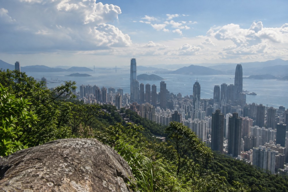
The western view is the one that decides whether you had a clear day. The distance to Lantau is short enough that haze erases it first, so the islands act as a built-in visibility gauge: if you can see the hills of Lantau, you have a genuinely clear afternoon, and the far skyline will be at its best too. If Lantau has vanished, stay for the night view instead, because the towers do not need visibility to perform.
The southern side of the hill is the quiet half. From Lugard Road's western stretch and from Harlech Road you look south over Aberdeen and the bays of the South Side, with green country park where most cities would have more towers. The operator's own Hong Kong Trail loop, out along Lugard Road and back via Harlech Road, takes in both halves, and the operator publishes it as a 40 to 60 minute walk starting from The Peak Tower's exit.
This is also the half of the hill where High West sits. At 493 metres, it is the sunset peak next door, and the tourism board calls it "one of the most famous sunset spots on The Peak". It is a hillside rather than a deck, so it suits photographers more than families, but it is free and it faces the western horizon where the sun goes down.
Free viewpoints or Sky Terrace 428: which do you need?
The panorama is free at the Peak Galleria rooftop viewing deck, along Lugard Road and Harlech Road, and at Victoria Peak Garden; the tourism board recommends all of them. Sky Terrace 428 adds the operator's 360-degree platform on the Peak Tower roof at 428 metres, admission alone HK$80 adult, and the operator describes it as "the highest observation deck in Hong Kong", a claim we quote rather than assert.
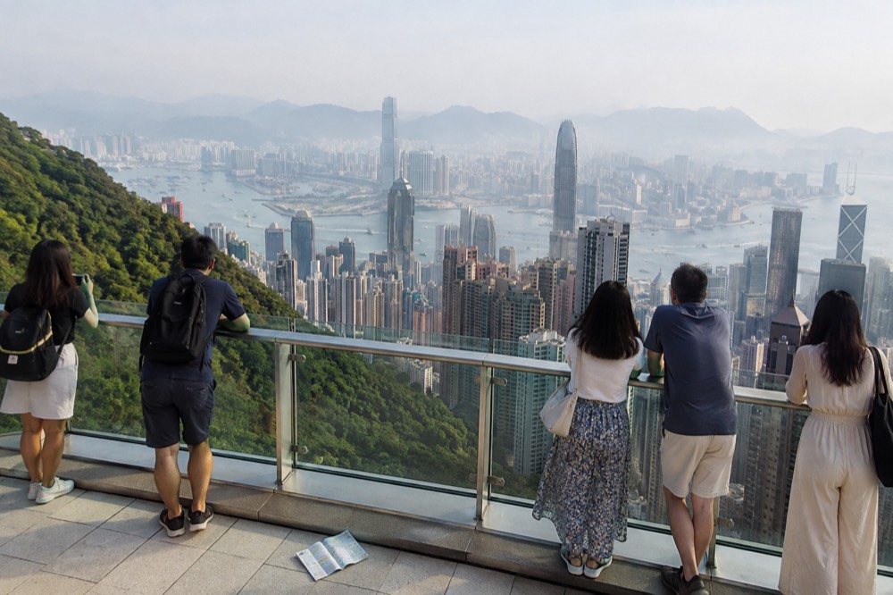
The honest three-way split is this. The view from the top of the hill is free at the Peak Galleria rooftop, which the tourism board describes as offering "panoramic views of Hong Kong's skyline, Victoria Harbour and beyond". What the Sky Terrace 428 ticket buys is the extra height on the tower roof and the operator's 360-degree deck. What the tram ticket buys is the ride. None of those three purchases includes the others unless you buy a combo.
| Viewpoint | Cost | What you get | Best for |
|---|---|---|---|
| Peak Galleria rooftop deck | Free | Rooftop panorama over the harbour | The view without paying |
| Lugard Road and Harlech Road | Free | Flat road loop, harbour constantly in view | An easy walk with the view |
| Victoria Peak Garden | Free | 554 m park, highest public ground | Quiet, green, above the deck |
| Sky Terrace 428 | HK$80 adult gate admission | 428 m roof platform, 360 degrees | Height and the full circuit |
| Tram ride | From $10.59 one-way adult, tram only | The funicular itself | The ride up |
No source compares the free deck's view against the paid deck's, and this site does not either. What can be said is structural: the garden is higher than the deck, the free rooftop is in the neighbouring building, and entering The Peak Tower itself costs nothing, so the shops, restaurants and indoor windows are open to anyone who rode up by bus. The operator's published fare ladder, including the combo prices, is on its ticket and booking page.
For readers weighing the paid deck against the city's other observation deck, the Sky Terrace 428 or Sky100 comparison covers the differences in height, side of the harbour and price. And if you already know you want the deck but not the ride, the sky-only option on the live listing covers exactly that: admission alone, for anyone arriving by bus, minibus, taxi or on foot.
Which months give you the view?
October, November and December are the clearest months on the Hong Kong Observatory's 30-year normals: October leads with 55 per cent of possible bright sunshine and 58 per cent cloud, December is the driest and least cloudy at 28.8 mm of rain and 57 per cent cloud. March and February are the worst for visibility, with 77 and 72 per cent cloud and most of the year's fog days between them.
These are Hong Kong-wide Observatory normals for 1991 to 2020, not measurements taken on Victoria Peak, and stating that scope honestly is part of using them. The reason March disappoints is fog rather than rain: the Observatory's fog-day measure, a day with visibility under one kilometre, averages 1.47 days in March and 1.10 in February, and the whole year averages only 3.70, so those two months hold most of the risk. February is dry, which is why rain-based seasonal advice wrongly calls it a good month.
| Month | Sunshine share | Mean cloud | Rain | Fog days |
|---|---|---|---|---|
| October | 55% | 58% | 120.3 mm | 0 |
| November | 52% | 58% | 39.3 mm | 0 |
| December | 48% | 57% | 28.8 mm | 0.03 |
| March | 27% | 77% | 75.3 mm | 1.47 |
| June | 36% | 77% | 491.5 mm | 0 |
Summer is sunnier than spring on this record, which contradicts most seasonal guides, but it pays for it in rain: June averages 491.5 mm across 19.33 wet days. There is also a typhoon dimension. The Observatory's normals put signal-8-or-above days at 0.80 in August and 0.67 in September, and when such a signal is hoisted the Peak Tram and Sky Terrace 428 close, per the operator's published rule. The operator also recommends checking the Observatory's two Victoria Peak webcams before travelling, one looking east and one looking north-northeast, which is the only live visibility check that exists.
On timing within a day, exactly one sentence of crowd guidance is published anywhere, the operator's own: visitors are "encouraged to purchase tickets in advance and come before 3pm during non-peak hours". No queue or wait figure exists for any hour or season, and this site does not invent one. The best time to visit the Peak guide works through the same evidence in more depth.
Photography, hours and practical notes for the view
Tripods and lighting equipment are not allowed in the Peak Tram, The Peak Tower or Sky Terrace 428, and drones are prohibited on the operator's property without permission. Sky Terrace 428 opens at 8:30 am and closes at 10 pm, while the tram runs from 7:30 am to 11 pm and the tower from 7 am to 11 pm, so early arrivals cannot use a combo ticket in full and late stays outlast the deck.
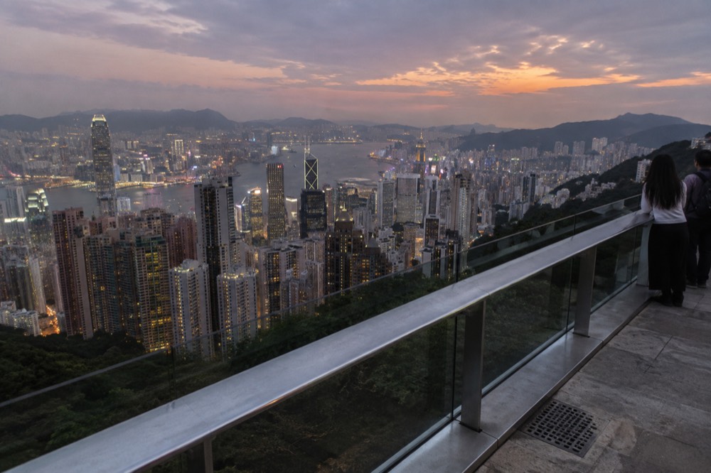
The hours trap cuts both ends. A visitor on the first tram of the day arrives a full hour before the deck opens, and a visitor lingering for the night view finds the deck shut an hour before the tram and the tower close. The free viewpoints have no published hours in our sources, and the free Peak Galleria rooftop deck's hours are not officially published either, so treat any figure you see elsewhere with caution.
A few small published facts help photographers. Free Wi-Fi is available at the tram termini, in The Peak Tower and on Sky Terrace 428, which matters at a spot where everyone wants to upload. The West Deck of Sky Terrace 428 can be hired as a private venue, which explains why part of the deck is sometimes roped off. And the operator's page on the tram cites a University of Hong Kong study, published in Psychological Science in 2013, that found passengers riding uphill experience a visual illusion in which the high-rises appear to lean toward the Peak, so the buildings will look tilted on the way up and that is your eyes, not the photo.
Families and drivers get two more published negatives worth planning around. There is no luggage storage at the tram stations or in The Peak Tower, and there is no car park in The Peak Tower, with parking at the adjacent Peak Galleria. Baby strollers must be folded before entering the tram and must not exceed 66 cm in width folded. Pets are allowed inside The Peak Tower on a leash or in a stroller, but not on the tram except qualified guide dogs.
If you plan to ride up and back and skip the deck, the round-trip tram option is the one that matches: HK$116 adult at the gate for both rides, no deck admission, which pairs naturally with the free viewpoints above. Check availability on the operator's live listing before you commit to a date, since tickets are sold for same-day visits and up to 30 days ahead.
However you get up and wherever you stand, the view rewards being able to read it. Knowing that the green at the eastern end is old barracks ground, that the straight shoreline is reclaimed harbour, that the islands on the western horizon are your visibility gauge, and that the quiet southern side has its own panorama, turns a photo stop into a half hour of actually looking. The hill gives all of that away for nothing, and sells only the height on top.
Common questions about the Victoria Peak view
Can you see Kowloon from the Peak?
Yes. Kowloon sits directly opposite across Victoria Harbour, and the peninsula runs east to west across the whole northern half of the panorama, from the old Kai Tak area through Tsim Sha Tsui to West Kowloon, with the Kowloon hills behind it.
Is the view from the Peak free?
Yes, at several points. The Peak Galleria rooftop viewing deck is free, the tourism board recommends it in its own words, and Lugard Road, Harlech Road and Victoria Peak Garden are free public spaces with the panorama. Only the Sky Terrace 428 platform on the Peak Tower roof is ticketed, at HK$80 adult gate admission.
What is the highest point you can stand on at the Peak?
Victoria Peak Garden, at 554 metres above sea level, is the highest ground the public can freely reach. The true summit, at 552 metres, is closed to visitors and occupied by a radio installation. Sky Terrace 428, at 428 metres, is the highest deck but not the highest ground.
Which side of the Peak has the skyline view?
The north and east faces. They look down over the Hong Kong Island skyline, Victoria Harbour and Kowloon. The southern side looks out over Aberdeen, the South China Sea and green country park, and is much quieter.
What can you see on a clear day from the Peak?
On a genuinely clear day you can see Lantau and the airport at Chek Lap Kok to the west, Lamma Island to the south, the Kowloon hills and the New Territories behind Kowloon, and the full Hong Kong Island skyline below. The visibility of Lantau is a reliable gauge of overall clarity.
Does the tram take you to the top of Victoria Peak?
No. The tram runs to Victoria Gap at 396 metres, a dip along the line of the hills where The Peak Tower stands. The summit at 552 metres is closed to the public. The operator states this plainly on its own history pages.